FEATURES
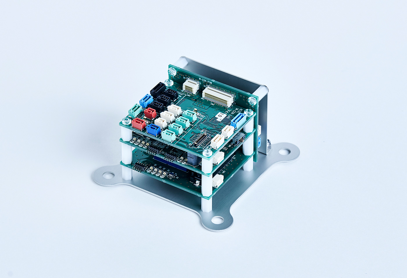
FEATURE 01
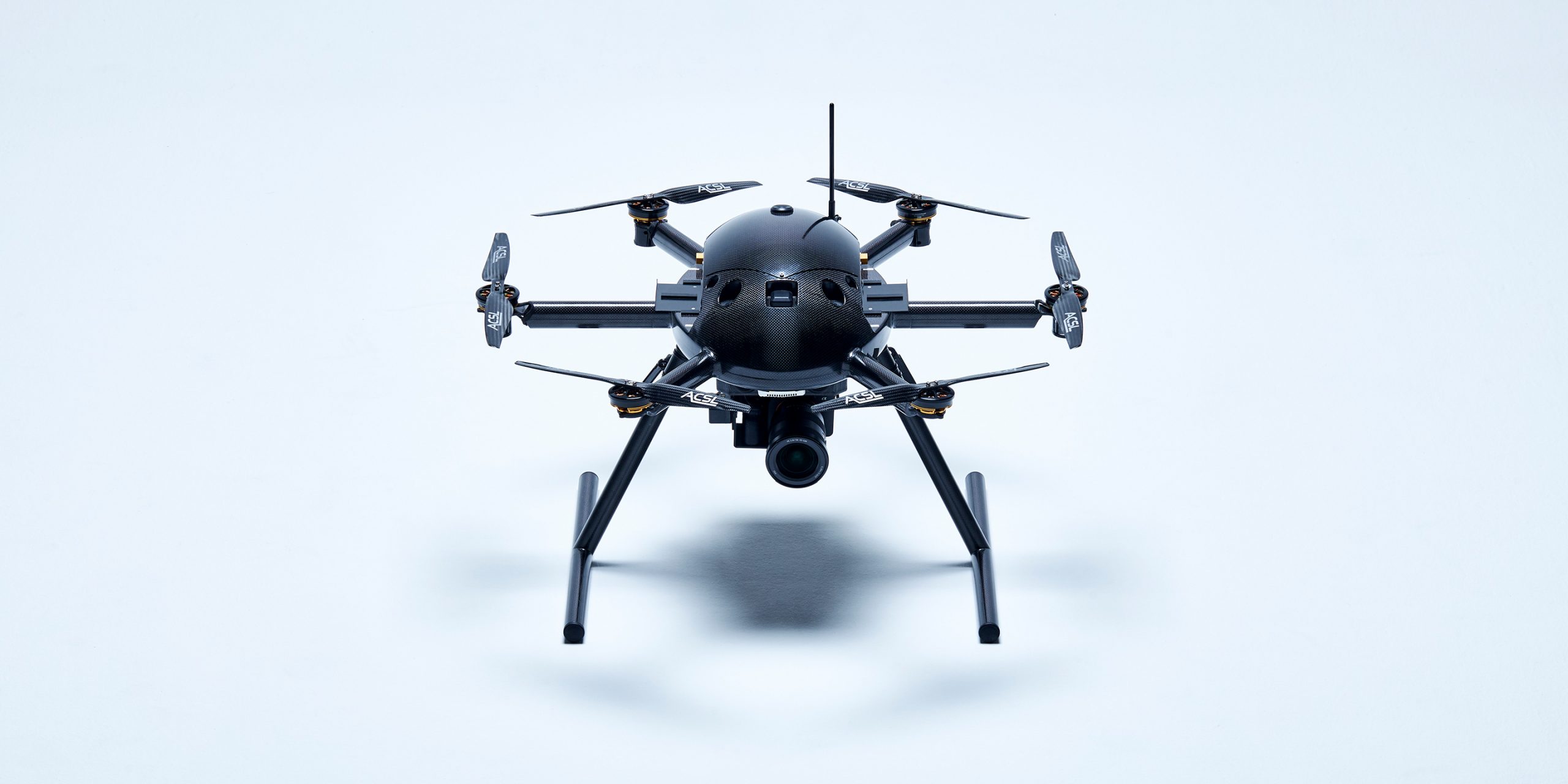
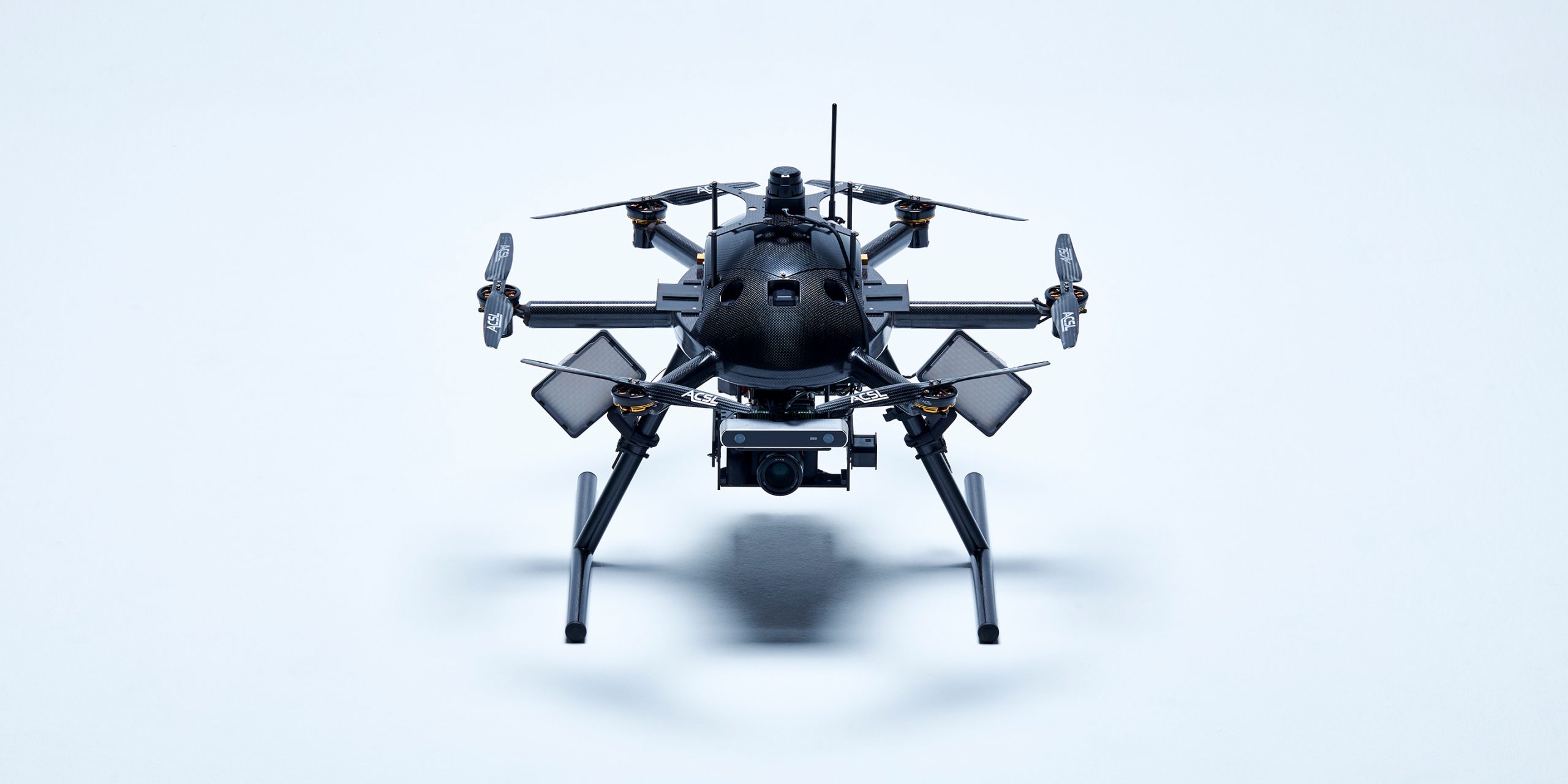
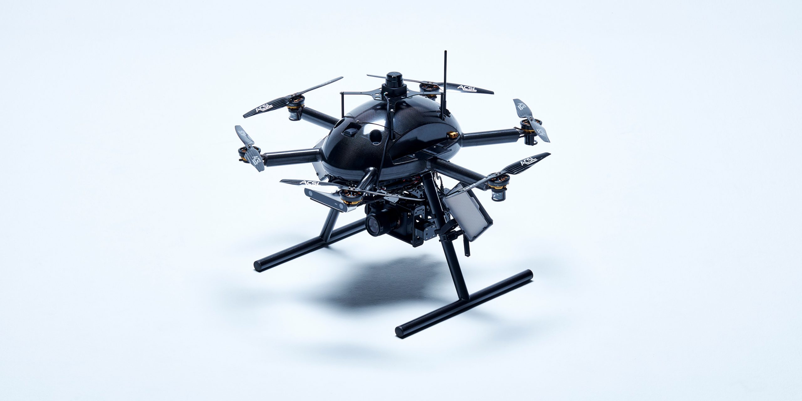
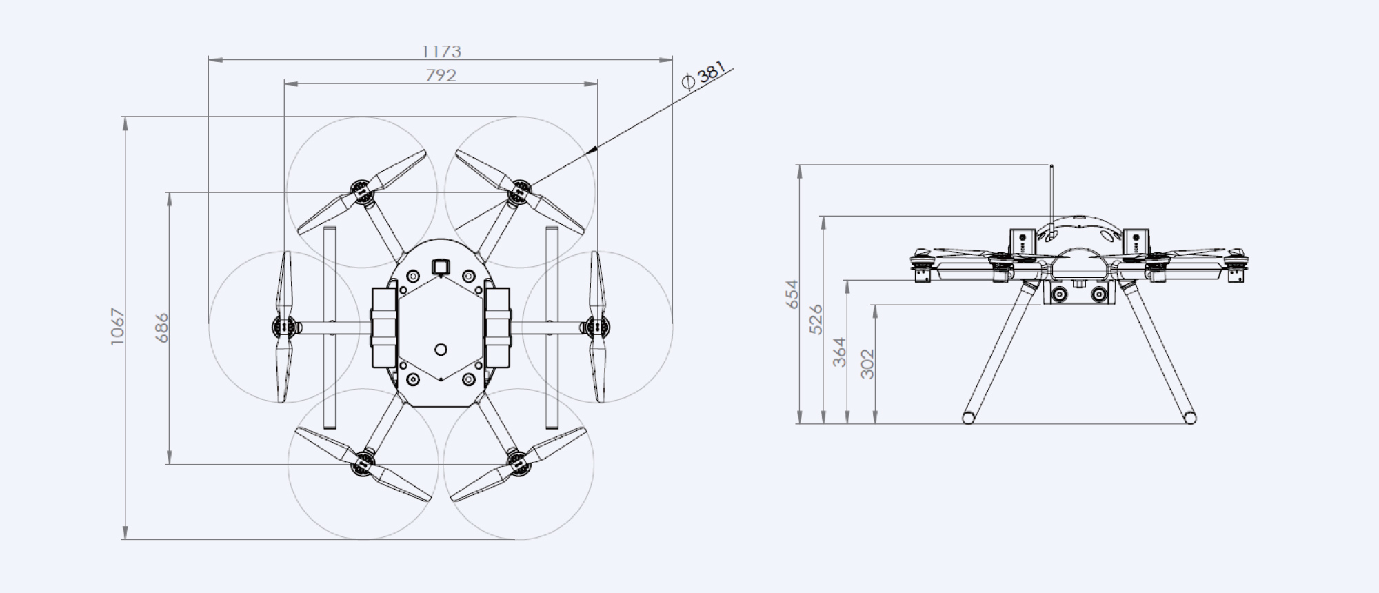
FLIGHT CONTROLLERACSL's proprietary control algorithmFlight controller is a critical component of the drone. ACSL has developed own flight controller based on proprietary advanced control algorithms.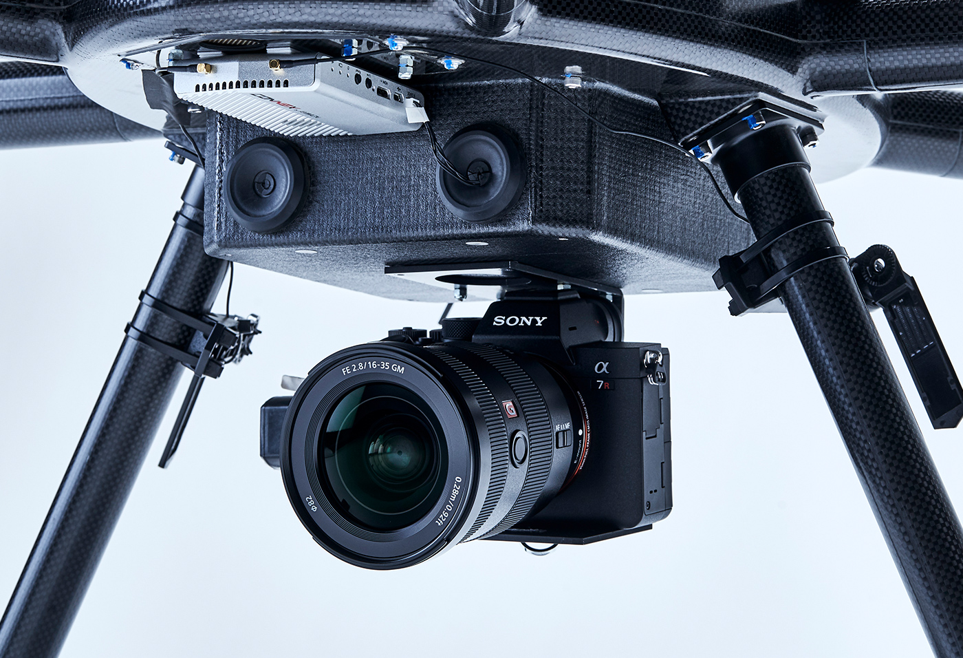
FEATURE 02
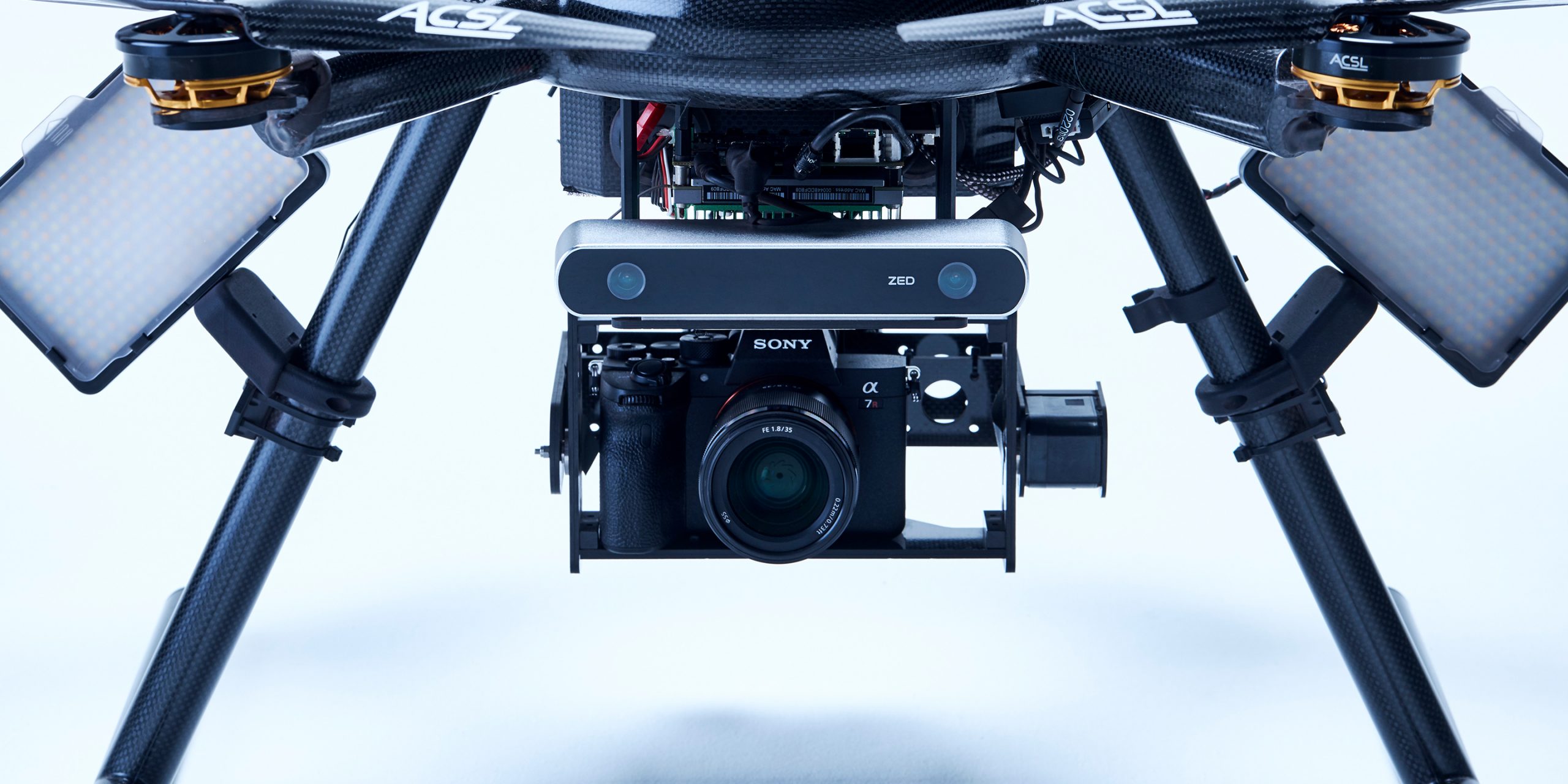
INSPECTION CAMERA0.5mm crack detectionA wide variety of cameras can be mounted as a payload. High-resolution cameras allows to detect up to 0.5mm degradation . (Example: SONY α7R4 70mm lens, shot from 5m distance)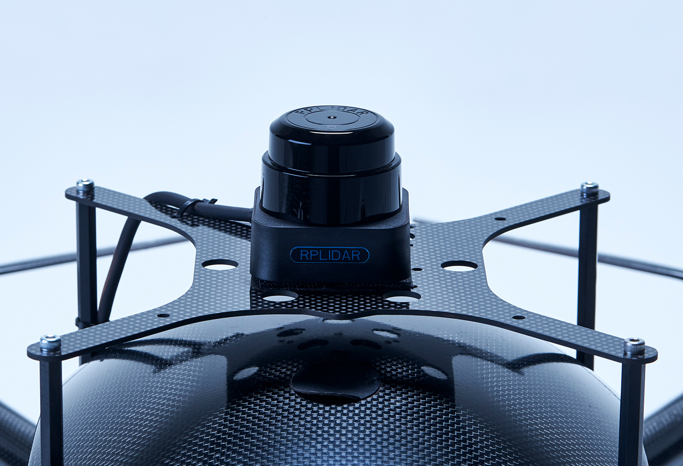
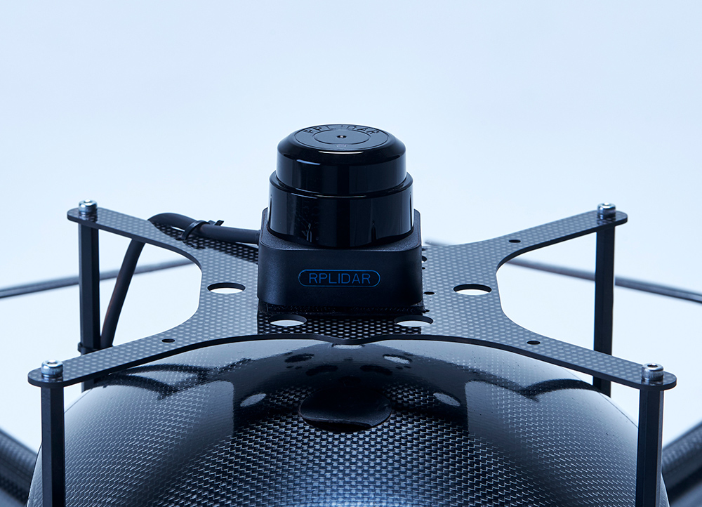
FEATURE 03
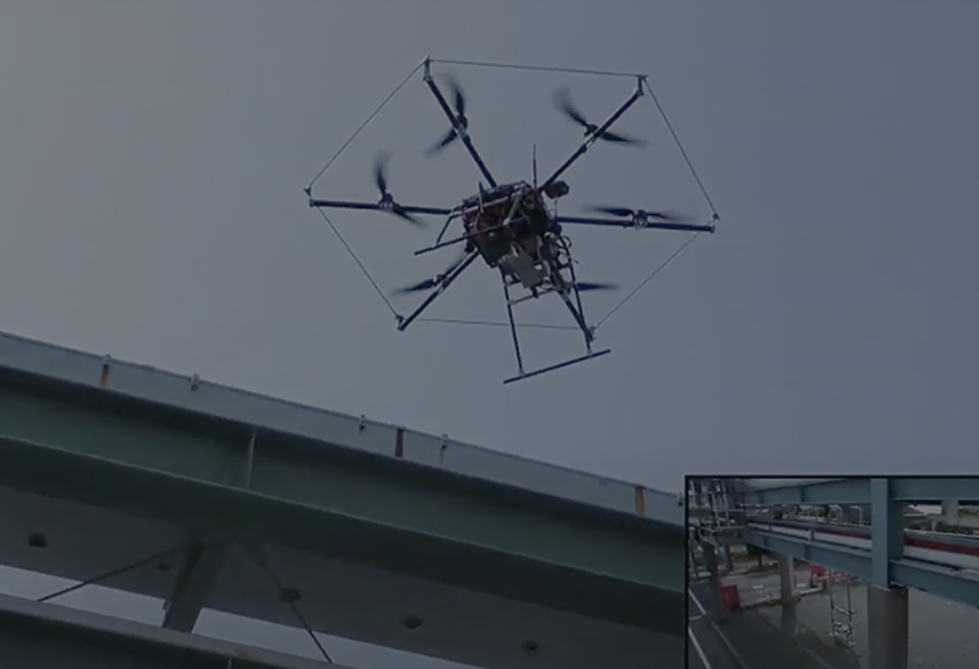
DRONE CONTROL WITH LiDARDrone control technology using LiDAR, which is good at confined spacesLiDAR technology makes it possible for drones to estimate their own position even in difficult situation for image recognition. (e.g. dark, no feature pattern.) Particularly in cylindrical structures such as tunnels and smoke stuck, where the cross-sectional structure is the same, is effective to control the position of the drone using LiDAR.-
FEATURE 01
FLIGHT CONTROLLERACSL's proprietary control algorithmFlight controller is a critical component of the drone. ACSL has developed own flight controller based on proprietary advanced control algorithms. -
FEATURE 02
INSPECTION CAMERA0.5mm crack detectionA wide variety of cameras can be mounted as a payload. High-resolution cameras allows to detect up to 0.5mm degradation . (Example: SONY α7R4 70mm lens, shot from 5m distance) -
FEATURE 03
DRONE CONTROL WITH LiDARDrone control technology using LiDAR, which is good at confined spacesLiDAR technology makes it possible for drones to estimate their own position even in difficult situation for image recognition. (e.g. dark, no feature pattern.) Particularly in cylindrical structures such as tunnels and smoke stuck, where the cross-sectional structure is the same, is effective to control the position of the drone using LiDAR. -
FEATURE 01
FLIGHT CONTROLLERACSL's proprietary control algorithmFlight controller is a critical component of the drone. ACSL has developed own flight controller based on proprietary advanced control algorithms. -
FEATURE 02
INSPECTION CAMERA0.5mm crack detectionA wide variety of cameras can be mounted as a payload. High-resolution cameras allows to detect up to 0.5mm degradation . (Example: SONY α7R4 70mm lens, shot from 5m distance) -
FEATURE 03
DRONE CONTROL WITH LiDARDrone control technology using LiDAR, which is good at confined spacesLiDAR technology makes it possible for drones to estimate their own position even in difficult situation for image recognition. (e.g. dark, no feature pattern.) Particularly in cylindrical structures such as tunnels and smoke stuck, where the cross-sectional structure is the same, is effective to control the position of the drone using LiDAR.
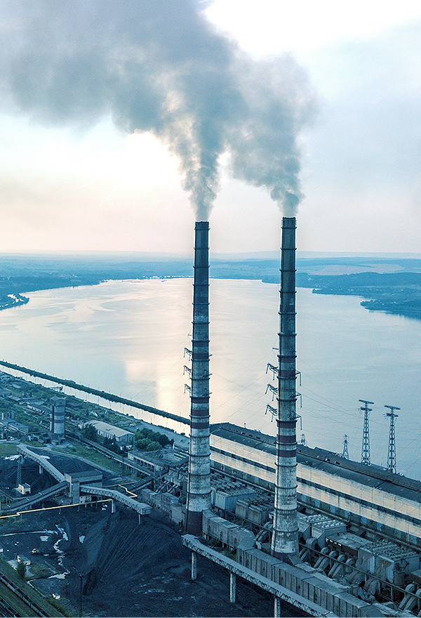
SCENE 01
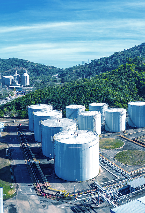
SCENE 02
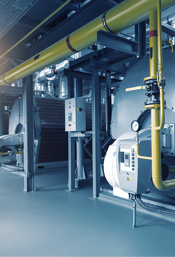
SCENE 03
The product specifications may change without prior notice.
The product specifications may change
without prior notice.
-
CASE 01
Plant facility regular monitoring using dronesDistance control for plant inspectionVisual SLAM technology can be applied to control drone at a constant distance from inspection target such as pipes and walls. This technology makes it easier to capture images at same angle, allowing inspector to compare the severity of the damage over time.
-
CASE 02
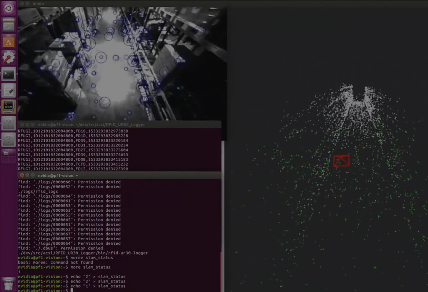
Visual SLAM for GPS-denied environmentVisual SLAM enabling indoor autonomous flightVisual SLAM computes drone position relative to the surrounding environment by extracting feature points and saving them as point cloud. This enables drone to conduct repetitive missions indoor, such as regular inspection of facility, warehouse stock counting, and tunnel inspection.
-
CASE 01
Plant facility regular monitoring using dronesDistance control for plant inspectionVisual SLAM technology can be applied to control drone at a constant distance from inspection target such as pipes and walls. This technology makes it easier to capture images at same angle, allowing inspector to compare the severity of the damage over time.
-
CASE 02
Visual SLAM for GPS-denied environmentVisual SLAM enabling indoor autonomous flightVisual SLAM computes drone position relative to the surrounding environment by extracting feature points and saving them as point cloud. This enables drone to conduct repetitive missions indoor, such as regular inspection of facility, warehouse stock counting, and tunnel inspection.